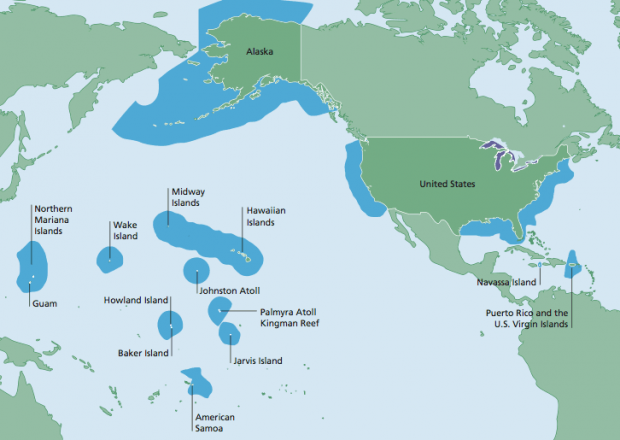
Sometimes customers ask us about how we define countries in our datasets. For example, we were recently quizzed over the US territories – why are Puerto Rico, Guam, Americal Samoa, et al, all have their own datasets? In another query from last year, there was a query about a Kosovo dataset.
In an attempt to remain impartial, and avoid any regional differences of opinion, we organize and publish our data to follow the ISO 3166-1 standard. This is closely aligned to the designations maintained by the United Nations, which we currently support as the most widely accepted definition in our markets. The standard allows our datasets be agnostic, and therefore flexible, to customer-specific interpretation of how a region is geographically or politically defined.
Read more about the ISO 3166-1 codes from Wikipedia and from ISO.
One thing ISO 3166-1 doesn’t provide, is a guide on how a country, region, or territory is named. Both ISO and Loqate turn to the UN to help define what to use as the primary or default values for dataset name.